Introduction Herb Crisler. Chris Morgenroth. Minnie Peterson. They were the lucky ones, the ones who pioneered on the land that is now Olympic National Park and Olympic National Forest.
There were earlier explorers: James Christie and Charles Barnes. They were among the first to see the blue ice of Olympic glaciers; the massive cedar, fir, and spruce cloaking the valleys; the roiling rivers filled with fish. Their tracks were made a scant eighty-five to one-hundred-fifty years ago, and as far as anyone knows, they were the first human tracks in the interior of the Olympic Mountains.
You may have heard of some of them. Herb Crisler filmed the 1952
The Olympic Elk for Walt Disney and in 1930—eight years before Congress created Olympic National Park—won a $500 bet he could spend 30 days in the Olympics carrying only a pocketknife, 75 pounds of camera gear and three carrier pigeons for what we might today call "real time" reports.
When he returned from that adventure, Crisler told a reporter in 1977, "I fell in love with the animals, and I vowed that if I ever got out alive, I wasn't going to hunt anymore, only photograph them. The more I photographed, the more I fell in love." Crisler's name and tireless work to establish a national park on the Olympic Peninsula is largely absent from park history.
Chris Morgenroth—some spelled his name "Morganroth"—was a pioneering forest ranger who homesteaded on the Bogachiel River in 1890. Minnie Peterson was a guide and packer in the Olympics for five decades whose family settled on the Hoh River in 1888.
James Christie was the leader of the 1889-1890
Seattle Press Expedition of the Olympic Mountains and Charles Barnes was one of those first explorers who braved one of the worst winters in Olympic history to forge a trail up the Elwha River and out the North Fork of the Quinault, mapping such places as the Bailey Range, which still has no developed trails. In recounting the adventure in the July 16, 1890 edition of the
Press, entitled "Found in the Olympics: A Resume of the Natural Resources of the Explored Region," he recorded wildlife the expedition members had seen. There were elk, deer, and bear, he said, and concluded his report by writing: "One goat was seen by the party."
That was about a quarter-century before Port Angeles hunters imported a dozen mountain goats to the Olympic Mountains, and a half-century before Congress created the national park. Barnes' journal entry and the
Press article is largely discounted by Olympic National Park officials, who maintain mountain goats are not native to the Olympic Mountains.
Imagine what it must have been like to be the first person to walk beside the Elwha River, or clamber across the Catwalk between Cat Peak and Mount Carrie. You'll find trails, both developed and boot-stomped at those spots today. It would be difficult, if not impossible, to find a single square inch of Olympic National Forest or Olympic National Park that hasn't been stepped upon by a human being. Still, the park and wilderness areas of the forest are as wild as any place you can find in the Lower 48.
When I first hiked to Moose Lake from Obstruction Point in 1969, I saw two other hikers on the trail. Hundreds make that trek on weekends today, campsites are reserved and park rangers patrol to enforce backcountry rules. During summers, park visitors must often wait in their cars at the Heart O' the Hills entrance station for up to 45 minutes before they are permitted to drive to Hurricane Ridge. Unless you have reserved a site ahead of time at Sol Duc or Kalaloch Campgrounds, you are likely to be sent elsewhere.
Thanks to protections provided by Congress, change walks slowly on this treasured land. However, a million more people visited Olympic National Park in 2019 than five decades before. Despite several notable exceptions in Olympic National Forest, those extra million crowd the same trails that were available 50 years ago. For the most part, the only additional trail miles have been added by roads closed by nature or policy.
Since the park was created in 1938, dozens of miles of roads have disappeared on the Skokomish, North Fork Skokomish, Hamma Hamma, Duckabush, Dosewallips, Elwha, and Quinault Rivers. Day hikes once considered to be of average difficulty, like Boulder Lake in the Elwha drainage or Diamond Meadows on the Dosewallips, have become strenuous for the average hiker to walk in a day. In 1975, you'd climb about seven miles, out and back, to Boulder; today, it's twelve—twenty-four, if the Olympic Hot Springs Road isn't fixed yet. Diamond Meadows was a thirteen-mile walk before the Dose Road washed away twenty years ago; now, it's twenty-five.
I believe the road closures will be good in the long term, once those in my pre-glacial generation have forgotten what it was like to drive to Olympic Hot Springs Campground, hike ten miles to Appleton Pass and back before soaking those sore muscles in the hot pools. The five-mile trek to and from today's trailhead is no longer on paved road and may someday not be recognizable as a former auto route. Nature may reclaim more roads in the Olympics, particularly where they are necessary only to serve hikers—roads such as those leading to Obstruction Point or Deer Park, North or South Forks of the Quinault.
Whatever the future holds for these roiling rivers, cloud-clawing peaks and ancient forests, the certainty is that as long as they remain protected, they'll be there for you and your children. In that sense, you're as lucky as Charles Barnes and the rest.
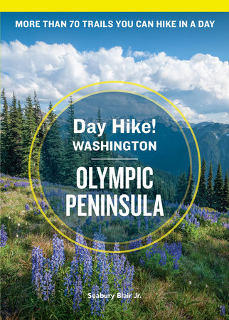
THE OLYMPIC PENINSULAAll but two hikes outlined in this guide are on a lumpy, green, decidedly wet spot of earth called the Olympic Peninsula. It is a unique place of great beauty, a day hiker’s dream.
You can walk a pristine ocean beach one day and on the next, stroll to the edge of a living glacier. You can watch orcas playing in the Strait of Juan de Fuca and, with a pair of good binoculars, see them from the tops of 6,000-foot peaks.
Few places anywhere in the Lower 48 are so crowded with wildlife: from seals and gray whales off the Pacific beaches to Roosevelt elk and Columbia blacktail deer of the high country; and from Obstruction Point’s radiator hose–chewing marmots to the killer raccoons of Ozette. Rare mountain goats, otters, eagles, ospreys, ravens—critters of every size and shape call the Olympic Peninsula home. There are so many varieties of slugs on the Olympic Peninsula that the whole place turns to slime during big rains. (You can check my research on that point if you want.)
And don’t get me started on trees and plants. Take nearly any one of the hikes in this book and you’re certain to see some Really Big Trees. In fact, seven of them are documented, world heavyweight champions. Wildflowers and green things are everywhere, from rare orchids to multiple varieties of ferns.
As interesting as the variety of Olympic plants and animals is the amazing weather dichotomy. The Olympic Mountains, at the heart of the Peninsula, generate their own weather. As storm clouds sweep off the Pacific Ocean, holding more water than a whole brewpub full of patrons waiting for a single stall, they dump all over the south and west sides of the mountains. Mount Olympus, the highest peak, gets more than 240 inches of precipitation every year. As a result, the clouds don’t have much left by the time they pass over the north and east sides of the mountains. Up there, fewer than 30 miles from Olympus, it rains only about 17 inches a year. A day hiker in search of sunshine, then, is more likely to find it on the trails in this so-called “rain shadow”: the Dungeness or Gray Wolf Rivers or the peaks and valleys of the eastern Olympics.
Yet as strange as it may seem, some wilderness pedestrians appear to enjoy, or at least tolerate, that wet stuff from the sky, especially in the rain forests where day hiking without moisture just doesn’t seem, well, proper.
Copyright © 2023 by Blair Jr., Seabury. All rights reserved. No part of this excerpt may be reproduced or reprinted without permission in writing from the publisher.