PREFACE This book grew out of our previous title,
Portlandness: A Cultural Atlas, in which we concentrated exclusively on the city where we live. After we finished the book, people asked us if there would be a sequel. Maybe another book about Portland? Or possibly one about other cities? We decided to do both.
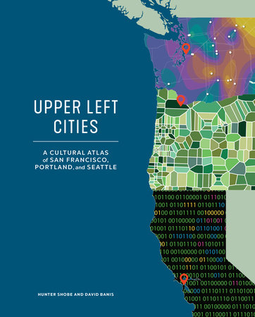
After spending years mapping and writing about one city, we resolved to compare cities. We were curious about how the big cities on the West Coast were alike and how they differed. Initially we wanted to include Oakland, California, and Vancouver, BC, but we decided to focus our efforts on San Francisco, Portland, and Seattle, the major West Coast cities in the northern part of the United States—or what we call the Upper Left.
We attempt to blend academic and popular styles, which is a difficult balance to strike. We hope to bring academic research to people who don’t usually read geography and urban studies journals, and bring storytelling and graphics to people who do.
Each of us has personal connections to these cities.
Hunter traces his personal Upper Left connections to the summer of 1994. That year he had tickets to World Cup games at Stanford Stadium and the Rose Bowl. So he drove from Washington, DC, and spent the summer traveling around California, Oregon, and Washington with a couple of friends. This was his first time west of the Mississippi. Just before the Nevada–California border, Hunter made his buddies pull over on the shoulder of the highway so that he could walk, rather than drive, across the state line to commemorate his first time in California.
Hunter visited San Francisco, Portland, and Seattle on this trip. A few months later, he moved to San Francisco, where he lived until the fall of 1998. In the twenty-plus years since, he has returned for days, weeks, and months at a time. From San Francisco, Hunter moved to Eugene, Oregon, to attend graduate school. He began to visit friends in Seattle every year. In the summer of 2006, he moved to Portland to teach at Portland State University. The Upper Left cities became personally stitched together when he met his wife (who grew up north of Seattle) on a blind date in Portland set up by mutual friends from San Francisco.
In researching this book, Hunter covered hundreds of miles (and wore through several pairs of Sambas) walking across the three cities. The initial idea for an atlas comparing multiple cities came to him on his four-mile walking commute to campus.
David spent his formative years in Southern California, but he has called the Upper Left home ever since. He went to college at UC Berkeley and spent his early working life in the Bay Area, and continues to visit family there regularly. An engineering job at Boeing led him to Seattle, just as the New York Times began fawning over the city, Starbucks went corporate, and the grunge era dawned.
David was drawn to Portland for graduate studies in geography at Portland State University, again just as the rest of the country was discovering the city. He managed to stick around the Portland State geography department after grad school, where he teaches courses on cartography and geographic information systems. With a population of almost 2.5 million people, Portland is the smallest metro area in which David has lived. He enjoys the charming small-town feel of inner-city Portland, while at the same time loving the energy and intensity of Seattle and the Bay Area. Like many a confirmed urbanite, he escapes the city to the mountains, or some other place without many people, every chance he gets.
Collaborator Zuriel has lived in the orbits of San Francisco, Portland, and Seattle for most of her life. She grew up in the Blue Mountains of northeastern Oregon, about 245 miles away from Portland, one of the closest major cities. Seattle, though slightly farther afield, formed more of Zuriel’s earliest impressions of city life. She took family trips to Seattle, where she visited her uncle and developed an affinity for bumptious gulls, endless drizzle, and Chinese seafood soups.
In adolescence, Zuriel moved from a town of about 650 people in rural Oregon to the bustling Bay Area, replacing pine trees with parking lots. Zuriel met her husband, Jonathan, while attending UC Berkeley. After graduation, and in search of a city with less bustle, more pine trees, and gloomier winters, they settled in Portland, where they have been ever since.
Like the three of us, everyone who worked on this atlas has deep connections to one or more of these cities. The result is that many perspectives are mixed into and shaped this book. While knowing that we could never include everything, through collaboration we hoped to explore as many features and connections of these cities as possible.
This is a book about San Francisco, Portland, and Seattle, but also a book about cities in general. We invite readers to reconsider their own blocks, neighborhoods, and cities and their many and varied connections.
This book came together with the contributions of students, alums, and colleagues at Portland State University, Portland Community College, and beyond. We all hold a deep respect for San Francisco, Portland, and Seattle, as well as for the people who live and work there. The responsibility of representing places in these three cities is one we took very seriously, even when adopting more playful themes and tones. Our goal was to display respect on every page.
Our team spent several years making this atlas, completing the final proofs in March 2020. We were on track for a fall 2020 release (or so we thought). The book was done. A few weeks later, COVID-19 upended lives throughout the United States, as it already had in places throughout the world. So much changed. This included our publication schedule which called for the book’s release to be delayed a year.
By the fall of 2020, we realized that the book was not done. It needed updates (the election pages, wildfires) and the addition of new topics (COVID-19 and protests). Forced to work quickly we made the additions and revisions as best we could. Most of the book is a snapshot of these cities just before the coronavirus struck. We hope this serves as a reference point for considering what has changed since.
INTRODUCTION: UPPER LEFT This atlas explores San Francisco, Portland, and Seattle through maps, graphics, essays, and photos. While not exhaustive, this is a wide-ranging collection of stories about these cities and how they compare, contrast, and connect. This is not a guidebook, but rather a guide to thinking geographically and creatively about places and how they change.
Why does this atlas focus on these three cities? Although each is distinct, they also share similarities and are linked through shared subcultures. If you do a quick search for the greenest, most sustainable, transit-friendly, bike-friendly, healthy, exciting, or promiscuous cities, or for the best cities for hipsters, cats, dogs, coffee, twenty-somethings, or foodies, all three of these cities are usually listed in the top ten.
These West Coast cities are sometimes referred to as the Left Coast—an unofficial cultural region referenced in various media. Left Coast has carried a variety of meanings over the past thirty years, although it most often signals the liberalism shared among many of its inhabitants. In the national imagination, the Left Coast comprises the entire US West Coast, including Los Angeles; “liberal Hollywood” is quintessential Left Coast. While it captures many of the common cultural characteristics of San Francisco, Portland, and Seattle, the Left Coast encompasses a broader region.
In this atlas, we place San Francisco, Portland, and Seattle in a more specific subsection of the Left Coast—the Upper Left. We think the shared cultural identities of these three cities and their surrounding areas deserve a special designation. The Upper Left is an emerging term, a fuzzy concept still coming into view. With this atlas, we hope to make this term more distinct.
San Francisco, Portland, and Seattle have each been the “it” city. Each city was launched into the popular imagination of the country at different times—San Francisco during the late 1960s and 1970s, Seattle during the 1990s, and Portland during the 2010s. The popularity of each city caused rents and home prices to rise and some neighborhoods to change rapidly.
The three cities are linked physically through several different transportation networks. A single highway nearly connects them. Driving from Seattle to Portland to San Francisco is largely a matter of sitting in Seattle traffic long enough to find I-5 South and following it for 750 miles before merging onto I-80 and sitting in Bay Area gridlock on the way to the Bay Bridge.
Every day, thirty-five flights connect Seattle and the Bay Area, twenty-three flights connect Portland and the Bay Area, and some dozen flights connect Seattle and Portland. The Amtrak Coast Starlight connects Seattle, Portland, and Oakland before continuing on to Los Angeles.
To go by boat is to travel the route that first connected the three Upper Left cities. Portland, located at the confluence of the Columbia and Willamette Rivers, is sixty miles by boat to the Pacific Ocean. Seattle, situated around Elliott Bay, connects to the Pacific by way of the Salish Sea. San Francisco Bay connects directly to the Pacific Ocean via the Golden Gate strait.
The ecosystems and climates of each city, although distinct, are similar too. In Portland and Seattle, it drizzles a lot for most of the year. San Francisco gets less rain and more fog. Seattle temperatures are a little colder. These are temperate places with occasional weather extremes.
BACK IN THE DAY
SAN FRANCISCO Before contact with Europeans, thousands of Ohlone lived in the Bay Area, including around the areas later known as Lake Merced and Mission Creek. In 1769, Europeans first caught sight of the bay during Gaspar de Portolá's overland expedition near present-day Pacifica.
In 1776, Spanish colonists arrived and founded the Presidio and Mission San Francisco de Asís (or Mission Dolores). The Mission, under the direction of Franciscan priest Junípero Serra, was named for Saint Francis of Assisi. The Mission chapel, still standing today, was built in 1791. The Spanish brought a new religion and an alien way of life to the native people, as well as the foreign disease of measles, which decimated the Ohlone and other native groups.
In 1821, Mexico declared itself independent from Spain, so San Francisco became part of Mexico. In the late 1830s, the slowly growing settlement was named Yerba Buena for a local plant. In 1847, to prevent an East Bay city from being named Francisca, the city was renamed San Francisco. That year, Irish engineer and surveyor Jasper O’Farrell platted a city plan with a diagonal double-wide boulevard that broke up the grid. Thus north–south streets rarely intersect at Market Street, causing daily traffic debacles today.
The biggest catalyst to San Francisco’s growth occurred outside of the city. In 1847, Swiss native John Sutter charged carpenter James Marshall with finding a location in the foothills of the Sierra Nevada for a lumber mill to serve San Francisco’s need for building materials. On January 24, 1848, Marshall found a small gold nugget in the mill’s tailrace. Upon hearing the news most San Franciscans promptly rushed to the hills in search of gold.
Word soon spread worldwide. In the first year about ten thousand miners flocked to Northern California in search of gold. In 1849, ten times that number came. Yerba Buena Cove became littered with abandoned ships, some of which are buried under the financial district today. Less than two years after gold was found, San Francisco’s population jumped from five hundred to twenty thousand. The city, as well as the rest of California, had become part of the United States in 1848 at the conclusion of the Mexican-American War.
In 1859, silver was discovered in western Nevada. The Comstock Lode provided a second boost of wealth and investment in San Francisco through the 1870s, during which thousands of new buildings were constructed.
The Central Pacific Railroad, which connected San Francisco to the East Coast, was completed in 1869. Chinese immigrants were the major labor force for West Coast railroad construction. Seeking economic opportunity, they were often subject to racist treatment. When the railroad was completed, many Chinese workers settled in San Francisco.
The last decades of the eighteen hundreds also saw the establishment of more than one hundred miles of cable car lines and the construction of Golden Gate Park, site of the California Midwinter International Exposition of 1894. As the map on the next page shows, at this time, urban development was minimal in the western half of the city.
On April 19, 1906, an estimated 7.7-magnitude earthquake shook San Francisco. After three days of fires, large parts of the city had been destroyed. Despite the massive losses, reconstruction of the city was rapid and most of downtown was rebuilt within three years.
Copyright © 2021 by Hunter Shobe and David Banis, with Zuriel van Belle. All rights reserved. No part of this excerpt may be reproduced or reprinted without permission in writing from the publisher.